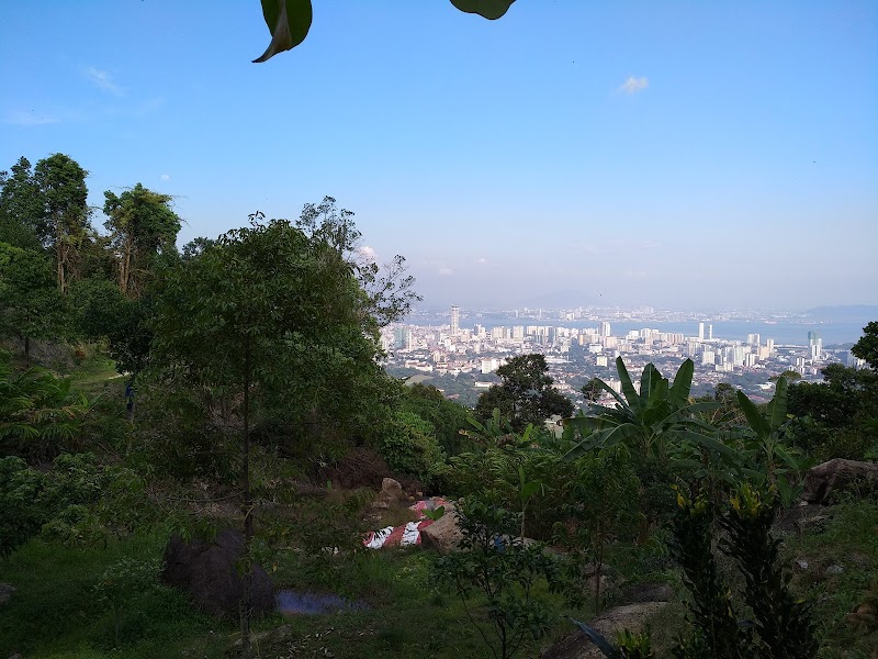
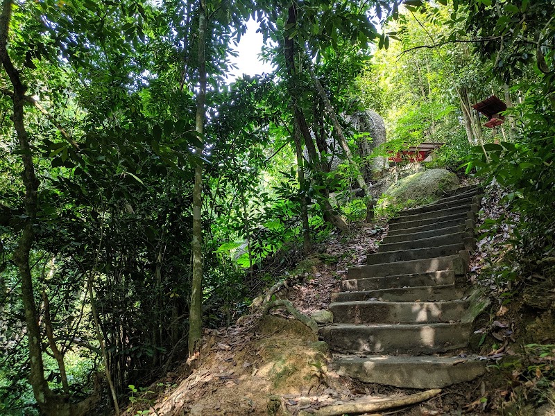
Malaysia is a treasure trove of natural beauty, offering a diverse range of hiking trails that cater to all levels of hikers. From leisurely strolls through lush rainforests to challenging ascents up towering peaks, these 5 trails are sure to leave you breathless.
- Mount Kinabalu Trail, Sabah
Towering at 4,095 meters, Mount Kinabalu is Malaysia’s highest peak and one of Southeast Asia’s most iconic landmarks. The 2-day/1-night or 3-day/2-night climbs to the summit offer stunning views of the surrounding rainforest, and the opportunity to witness a diverse range of flora and fauna.
- Gasing Hill Trail, Selangor
Located just a short distance from Kuala Lumpur, Gasing Hill offers a challenging 3-hour hike with rewarding views of the city and surrounding countryside. The trail takes you through a mix of forest trails, rocky sections, and a series of steep climbs, making it a popular choice for both locals and tourists.
- Cameron Highlands Trail, Pahang
Nestled in the rolling hills of Pahang, the Cameron Highlands is known for its cool climate and lush tea plantations. The area offers a variety of hiking trails, ranging from easy walks to more challenging treks. Some popular trails include the Gunung Brinchang Trail, which leads to the highest peak in the Cameron Highlands, and the mossy forest trail of Gunung Irau.
- Mount Ophir Trail, Johor
Rising 1,276 meters above sea level, Mount Ophir is the highest peak in Johor. The 2-day/1-night hike to the summit offers stunning views of the surrounding rainforest, waterfalls, and rock formations. The trail is well-maintained and suitable for hikers of all levels.
- Kota Kinabalu Wetlands Trail, Sabah
The Kota Kinabalu Wetlands Trail is a 1.6-kilometer boardwalk that takes you through the largest mangrove forest in Sabah. The trail offers a unique opportunity to experience the diverse flora and fauna of this important ecosystem, including a variety of bird species, reptiles, and amphibians.

The 7 Biggest Hiking Trail near Penang
Bukit Hijau, Cangkat Tembaga Hiking Trail
- Address: Cangkat Tembaga, Taman Greenview, Jelutong, Pulau Pinang, Malaysia
- Map: Click here
- Rating: 4.5 (314)
- Reviews:
4 months ago(Visited on 16th Sept) Do mind that the ladder trail has been demolished due to the recent development.However, you are able to reach the hill top by another trail.
Waterfall is not able to enter now and council people are always patrolling around (it’s a good initiative because not safety)
6 months agoHeavy construction in the lower sections but the trail is still usable. Maintenance has dropped recently but the path is still safe and relatively easy to navigate.Excellent viewpoints of multiple angles of Penang Island. Could do with a little more signage, but overall a relaxing meditative and short hiking trail with an outdoor badminton court and several rest stops along the way.
Bring insect repellant. Plenty of shade so not to hot though.
4 months agoEasy trail for hiking, with nice view on top.Recently there is construction on the road there, thus the old hiking entrance is changed. May walk further abit into the road and you shall able to found the “Bukit Hijau” road sign for the new hiking entrance.
The hiking trail is abit slippery after rain, take note and be careful.
11 months agoQuite an easy hike, can reach the peak within 30 minutes and you will be rewarded with nice sceneries from ~3 viewing spots.Bukit Hijau (directly translated as Green Hill) is also known as Fish Head Hill as you will pass by a big rock that shaped like a fish head from certain angle. At the middle and peak, there are also a flat space where you can play badminton. During certain time of the day, there could be so dogs at the peak but they are *usually* not aggressive.
a year agoThere few paths leading to different hills. But for Bukit Hijau, when goes up and back have to be same road, else, you will end up to different location, which you might have to take grab back to where you parked or economy way, walk back ?. For the trail, quite slippery, have to be more careful on your own steps though there is available of rope at some challenging points. ? Enjoyed the hiking, as end with mesmerising view and precious group photos with the gang.
Penang Hill Heritage Trail
- Address: 478, Jalan Pokok Ceri, 11500 Ayer Itam, Pulau Pinang, Malaysia
- Map: Click here
- Rating: 4 (57)
- Website:
- Opening hours:
Monday: Open 24 hoursTuesday: Open 24 hoursWednesday: Open 24 hoursThursday: Open 24 hoursFriday: Open 24 hoursSaturday: Open 24 hoursSunday: Open 24 hours - Reviews:
a week agoStarting point at the archway is not too far from the open space car park behind the Lower Station. Just follow the other hikers, this is a popular trail to Penang Hill. Staircases all the way up until middle station. Steps are not uniform. Pass by Claremont and Viaduct stations, too. Some parts in jungle after Claremont Station.a month agoThe track is direct and the extremely steep until the middle station. Pack sufficient water and empty your bladder before you hike.Here’s the tricky part :
When you get to the middle station, you have two options. Either you continue your way up but be prepared to greet a pack ( or two) of stray dogs. They are just doing their job , guarding the area but can be intimidating if you’re a solo hiker or are not a fan of dogs. From our past encounter, they did not bite but they do approach you.
This time around, we decided to switch our routes . we walked back to the middle Station to switch on the right side( coming down) of the station. If you’re coming up, this track is on your left . You will see a small quarters as you exit the middle station.
This track will show you nice views of Air Itam . It was ok , definitely longer than the other track but was seriously lacking signs. We were lost a few times ( ending up in some gardens and dead ends) but a resident was kind enough to show us the way.
Expect 2 hours to go up ( inclusive of water breaks)
Pack a walking stick along with you to be safe
2 weeks agoA lovely hike up Penang Hill. The entire hike up the hill took 2 hours at a very easy pace. Best done early morning on weekdays (avoid weekends and school holidays, due to the crowds).Take the paved road on the right of the Jade Emperor God Temple/Thean Kong Thnuah Temple until you reach the Heritage Trail (see photo of sign).
Then climb the steps all the way to Upper Station. The views at Middle Station are almost better than the Upper Station, due to the number of buildings up top, so savour the views on the way up.
6 months agoIf you read most reviews if this trail it’s classed as easy. It has over 3,000 steps just to the middle station. Trust me, its an easy track, but physically it’s not an easy hike. I came across many people that did not have enough water, food, or correct footwear. Its up, up, up. If you come prepared, it will take you between 2hr and 3hrs to the top it’s a good enjoyable hike. The first part is steps all the way to the middle station. From there it’s up via forest tails and tracks. I certainly enjoyed the hike. It’s between 90min and 120mins down.2 months agoNot the best trail on offer in my opinion. There are more scenic routes up / down but this is the most direct. On the way down this trail we encountered the giant squirrel and a very close encounter to the dusky leaf monkeys too! Don’t bother with the train take the trail if you’re able. It takes to e same amount of time when you factor in the waiting times.
Bukit Jambul Hiking Trail Entrance
- Address: Lintang Bukit Jambul 1, Bj Cove, 11900 Bayan Lepas, Pulau Pinang, Malaysia
- Map: Click here
- Rating: 4.6 (410)
Penang Hill Hike
- Address: 11500 Air Itam, Penang, Malaysia
- Map: Click here
- Rating: 4.6 (145)
Trail Rest No. 3 to Penang Hill
- Address: Pulau Tikus, George Town, Penang, Malaysia
- Map: Click here
- Rating: 4.4 (26)
By Path C – Upper Entrance
- Address: By Path D Trail, Bukit Bendera, Penang, Malaysia
- Map: Click here
- Rating: 4 (12)
Zi Zai Hill
- Address: Penang, Malaysia
- Map: Click here
- Rating: 4.4 (55)

Explore prominent consulting firms in neighboring countries, such as those referenced in Kuala Lumpur, Pakse and Luang Prabang, to gain insights into the dynamic business landscape of ASEAN. These firms contribute to the region’s enterprise vibrancy, positioning Penang, Malaysia as a hub for strategic insights and innovative solutions.
Top Hiking Trail Alternatives in Penang

The Biggest Hiking Trail in Malaysia
Penang, a picturesque state in Malaysia, is known for its stunning natural beauty and diverse hiking trails. If you’re an adventure enthusiast looking for an alternative to the usual hiking spots, here are three top hiking trail alternatives that are popular among locals and tourists:
- 1. Penang Hill Circular Trail: This 10-kilometer trail is one of the most popular alternatives to the crowded Penang Hill. It offers a challenging hike through lush rainforests and offers stunning views of the island. The trail starts at the base of Penang Hill and takes you through a series of steep climbs and descents. Along the way, you’ll come across beautiful waterfalls, hidden temples, and even a monkey rehabilitation center. Make sure to carry plenty of water and wear proper hiking shoes for this adventure.
- 2. Teluk Bahang to Muka Head Trail: If you’re up for a longer hike, the Teluk Bahang to Muka Head Trail is a must-try. This 17-kilometer trail takes you through the Penang National Park and offers breathtaking views of the coastline. The trail starts at Teluk Bahang and winds its way through dense forests, rocky terrains, and pristine beaches. You’ll also have the chance to spot wildlife like monkeys, monitor lizards, and various bird species. Don’t forget to pack some snacks and sunscreen for this all-day adventure.
- 3. Bukit Mertajam Forest Reserve Trail: For a more off-the-beaten-path experience, head to the Bukit Mertajam Forest Reserve. This trail is not as well-known as the others, but it offers a tranquil escape from the city. The trail starts near the outskirts of Bukit Mertajam and takes you through a dense forest filled with towering trees and diverse flora and fauna. As you hike, you’ll come across small streams, natural pools, and even a hidden waterfall. It’s a great trail for nature lovers looking for a peaceful and serene hiking experience.
These hiking trail alternatives in Penang offer a chance to explore the state’s natural beauty while avoiding the crowds. Whether you’re a beginner or an experienced hiker, these trails provide varying levels of difficulty and stunning scenery. So, lace up your hiking boots and get ready to embark on an unforgettable outdoor adventure in Penang.
Thank you for taking the time to read our article. For more in-depth reviews and comprehensive ratings on the Hiking Trail spots, please explore the recommended articles listed below.
- Top 3 Largest Island in Malaysia
The country of Malaysia contains a collection of major islands that present diverse cultural features and beautiful landscapes together with..
- The 5 Biggest Mosque in Malaysia
Malaysia contains remarkable mosques that unite traditional Islamic architecture elements with contemporary designs. These mosques function as religious establishments while..
- The Biggest ÆON in Malaysia
ÆON provides shoppers with an exceptional retail experience according to most people who hear about it. The largest ÆON establishment..
- 7 Salon Muslimah Pilihan di Seremban
Seremban, Negeri Sembilan Malaysia merupakan wilayah yang ideal untuk bisnis kecantikan. Selain terdapat pusat-pusat kecantikan, di Seremban juga tersedia layanan..

